
First, this photo links to a video tour on YouTube, just under nine minutes, taken in June 2011. That will give you a sense of how it's laid out, and then you can click on the still photos below for more detail. Unless otherwise noted, all photos were taken in June 2009.

When you're driving to the land, this is what it looks like when you first see it. The south boundary is just this side of the two red posts. Those brown trees in the center were killed by heat when I burned the big slash pile that was in front of them. Behind them is the north hill, with the north line roughly at the ridge on top, 660 feet from the south line.

Here's what I call the parking lot. Before the logging in summer of 2002, there was dense forest here. When I first saw it two years later, it was still completely dead, but now it's coming back. That pile of sticks is made of branches from two western hemlocks that fell in early 2007. Wood from those trees made the lower half of the cobwood hut.

Toward the left of the above photo, you can see the outhouse roof and the dead fridge that I use for storage. This photo and the next two were taken from roughly between them. Now we're looking back the way we came at the parking lot and the access road.

A closer look at the outhouse, which becomes a storage shed in winter. In front of it is a montmorency cherry, with three different devices to keep it straight after it got bent and nearly broken by snow. Those white flowers are yarrow, and the really big leaves are thimbleberry.

The north hill in June, with my new canvas tent where I was originally planning to build the cabin. In September, the dominant color will be dull brown. The main native plants on the north hill are snowberry, mallow ninebark, baldhip rose, spreading dogbane, and snowbrush ceanothus.

At the bottom of the last shot you can see the path continuing along the bottom of the north hill. Up ahead of this shot it curves again to the left and goes up to the spring.

This is the pool I made below the spring. In the top center you can see a copper pipe sticking out of the hill with water coming out. The other end of the pipe collects the water from under the main spring pool. The big maple-like leaves are thimbleberry and the leaves above them are wild sarsaparilla.

And here's the spring pool itself. I couldn't get a new photo better than this one from April 2006. By June, those mats of algae have turned brown.

There's another path down from the spring, and if you walk a bit and look left (north), you see what I call the central clearing, or the orchard. On the right side of the photo is the Prairie Spy apple tree.

From the last view, if you walk south about 50 feet, you're standing in what I'll call the meadow. The grass is reed canarygrass, which gets six feet tall in August. Here we're looking east, down the path that leads back to the parking lot. Those brown trees in the center are the same brown trees in the first couple of images.

Now if you turn completely around, you're looking up the west hill. That tall stump near the top is one of the most distinctive features on the land, and it's farther up than it looks here. The west edge of the property is a bit this side of the ridge.

Now we've climbed up to beyond the tall stump, which you see on the left. We're looking north by northeast, down the west hill and up the north hill. The main trees in the canyon are grand fir, western redcedar, douglas fir, and western hemlock.

Climbing down the west hill, and up the north hill, here's the view south. Most of the trees up here are the more drought-tolerant ponderosa pine. I tried to grow stuff on this slope and it all died or had to be transplanted to save me the trouble of hauling water up, except for two goumis. That white patch in the upper right is the neighbor's A-frame cabin.

If you go farther up the north hill, you can look back and see this nice view. The pale line in the distance is where Highway 2 passes. If you go even farther up, there's an abandoned dirt road, and if you go farther yet, you come to the ridge where people sometimes drive their ATV's.

The next few shots are from early November 2008. Here's the parking lot area, and notice that the big slash pile has not burned and killed the trees yet. Those bright yellow trees are western larch, a decidous conifer.

And the north hill. I think the camera lens was a little dirty. The reddish leaves are bracken fern.

Again, looking up the west hill.

And here I'm standing up on the hill, near the center of the previous shot, looking down.

Finally, here are some shots from December 2006, taken with a digital camera so old it used a floppy disk. I bought some good boots and walked in two miles from the end of the pavement to see what the land looks like covered with snow. This first photo is the approach.

There were animal tracks everywhere! Here I'm looking back the way I came across the parking lot. The human-like track on the right is mine. All the others are critter highways, mostly deer.

The spring in winter, still running! On my way up I scared away a young deer that was taking a drink. You can see from the tracks that this is a popular spot.

The west hill. All it needs is a little cabin in the middle and it's a Christmas card photo. The sun is out and the temperature is getting above freezing for the first time in a couple weeks, and powdery snow is falling everywhere from the trees.

I made a trail angling from the spring up toward the southwest corner of the land, and in the snow I discovered that deer are using it. Here we're looking west and there's that tall stump again.

And here I'm near the southwest corner looking back northeast over the land, down the west hill and up the north. The snow up here was almost a foot deep. At the end of 2008 it would have been five or six feet.
 When you're driving to the land, this is what it looks like when you first see it. The south boundary is just this side of the two red posts. Those brown trees in the center were killed by heat when I burned the big slash pile that was in front of them. Behind them is the north hill, with the north line roughly at the ridge on top, 660 feet from the south line.
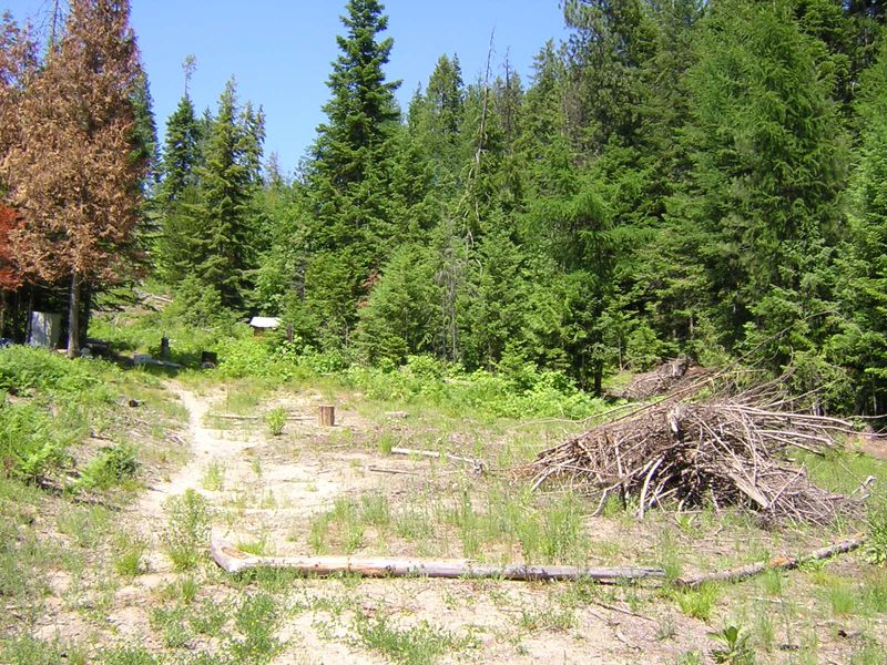 Here's what I call the parking lot. Before the logging in summer of 2002, there was dense forest here. When I first saw it two years later, it was still completely dead, but now it's coming back. That pile of sticks is made of branches from two western hemlocks that fell in early 2007. Wood from those trees made the lower half of the cobwood hut.
 Toward the left of the above photo, you can see the outhouse roof and the dead fridge that I use for storage. This photo and the next two were taken from roughly between them. Now we're looking back the way we came at the parking lot and the access road.
 A closer look at the outhouse, which becomes a storage shed in winter. In front of it is a montmorency cherry, with three different devices to keep it straight after it got bent and nearly broken by snow. Those white flowers are yarrow, and the really big leaves are thimbleberry.
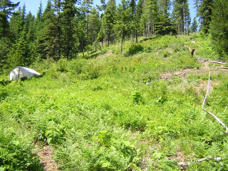 The north hill in June, with my new canvas tent where I was originally planning to build the cabin. In September, the dominant color will be dull brown. The main native plants on the north hill are snowberry, mallow ninebark, baldhip rose, spreading dogbane, and snowbrush ceanothus.
 At the bottom of the last shot you can see the path continuing along the bottom of the north hill. Up ahead of this shot it curves again to the left and goes up to the spring.
 This is the pool I made below the spring. In the top center you can see a copper pipe sticking out of the hill with water coming out. The other end of the pipe collects the water from under the main spring pool. The big maple-like leaves are thimbleberry and the leaves above them are wild sarsaparilla.
 And here's the spring pool itself. I couldn't get a new photo better than this one from April 2006. By June, those mats of algae have turned brown.
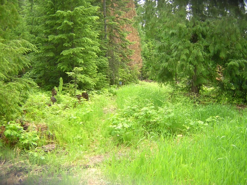 From the last view, if you walk south about 50 feet, you're standing in what I'll call the meadow. The grass is reed canarygrass, which gets six feet tall in August. Here we're looking east, down the path that leads back to the parking lot. Those brown trees in the center are the same brown trees in the first couple of images.
 Now if you turn completely around, you're looking up the west hill. That tall stump near the top is one of the most distinctive features on the land, and it's farther up than it looks here. The west edge of the property is a bit this side of the ridge.
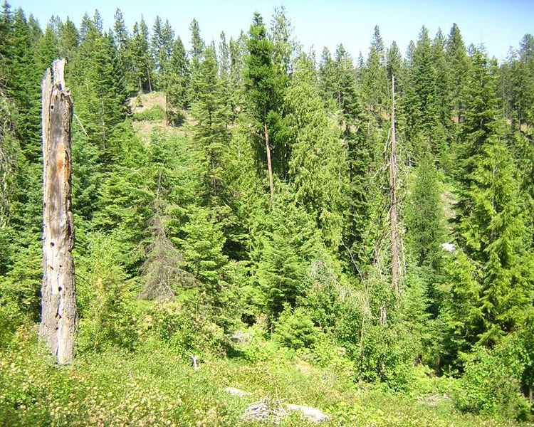 Now we've climbed up to beyond the tall stump, which you see on the left. We're looking north by northeast, down the west hill and up the north hill. The main trees in the canyon are grand fir, western redcedar, douglas fir, and western hemlock.
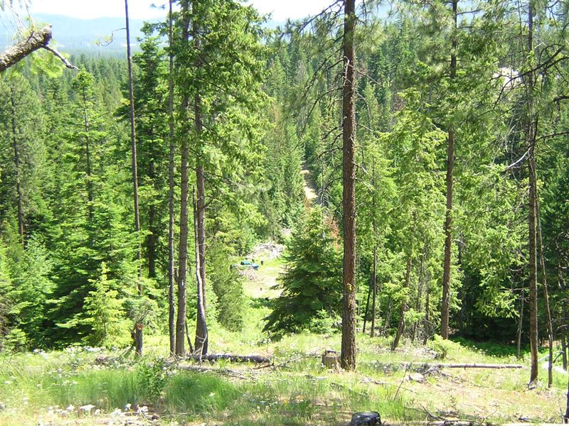 Climbing down the west hill, and up the north hill, here's the view south. Most of the trees up here are the more drought-tolerant ponderosa pine. I tried to grow stuff on this slope and it all died or had to be transplanted to save me the trouble of hauling water up, except for two goumis. That white patch in the upper right is the neighbor's A-frame cabin.
 If you go farther up the north hill, you can look back and see this nice view. The pale line in the distance is where Highway 2 passes. If you go even farther up, there's an abandoned dirt road, and if you go farther yet, you come to the ridge where people sometimes drive their ATV's.
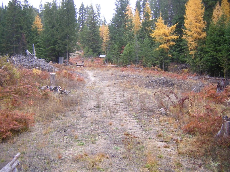 The next few shots are from early November 2008. Here's the parking lot area, and notice that the big slash pile has not burned and killed the trees yet. Those bright yellow trees are western larch, a decidous conifer.
 And the north hill. I think the camera lens was a little dirty. The reddish leaves are bracken fern.
 Again, looking up the west hill.
 And here I'm standing up on the hill, near the center of the previous shot, looking down.
 Finally, here are some shots from December 2006, taken with a digital camera so old it used a floppy disk. I bought some good boots and walked in two miles from the end of the pavement to see what the land looks like covered with snow. This first photo is the approach.
 There were animal tracks everywhere! Here I'm looking back the way I came across the parking lot. The human-like track on the right is mine. All the others are critter highways, mostly deer.
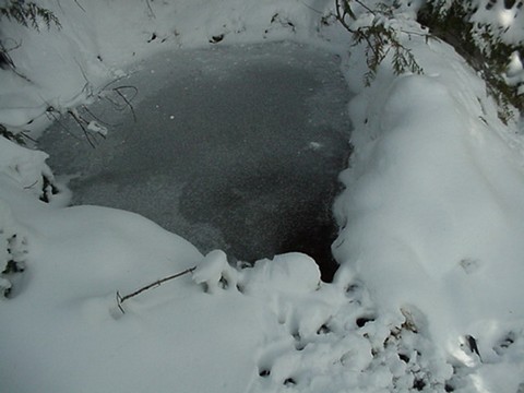 The spring in winter, still running! On my way up I scared away a young deer that was taking a drink. You can see from the tracks that this is a popular spot.
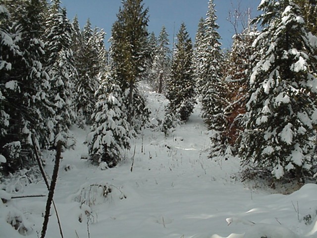 The west hill. All it needs is a little cabin in the middle and it's a Christmas card photo. The sun is out and the temperature is getting above freezing for the first time in a couple weeks, and powdery snow is falling everywhere from the trees.
 I made a trail angling from the spring up toward the southwest corner of the land, and in the snow I discovered that deer are using it. Here we're looking west and there's that tall stump again.
 And here I'm near the southwest corner looking back northeast over the land, down the west hill and up the north. The snow up here was almost a foot deep. At the end of 2008 it would have been five or six feet.